

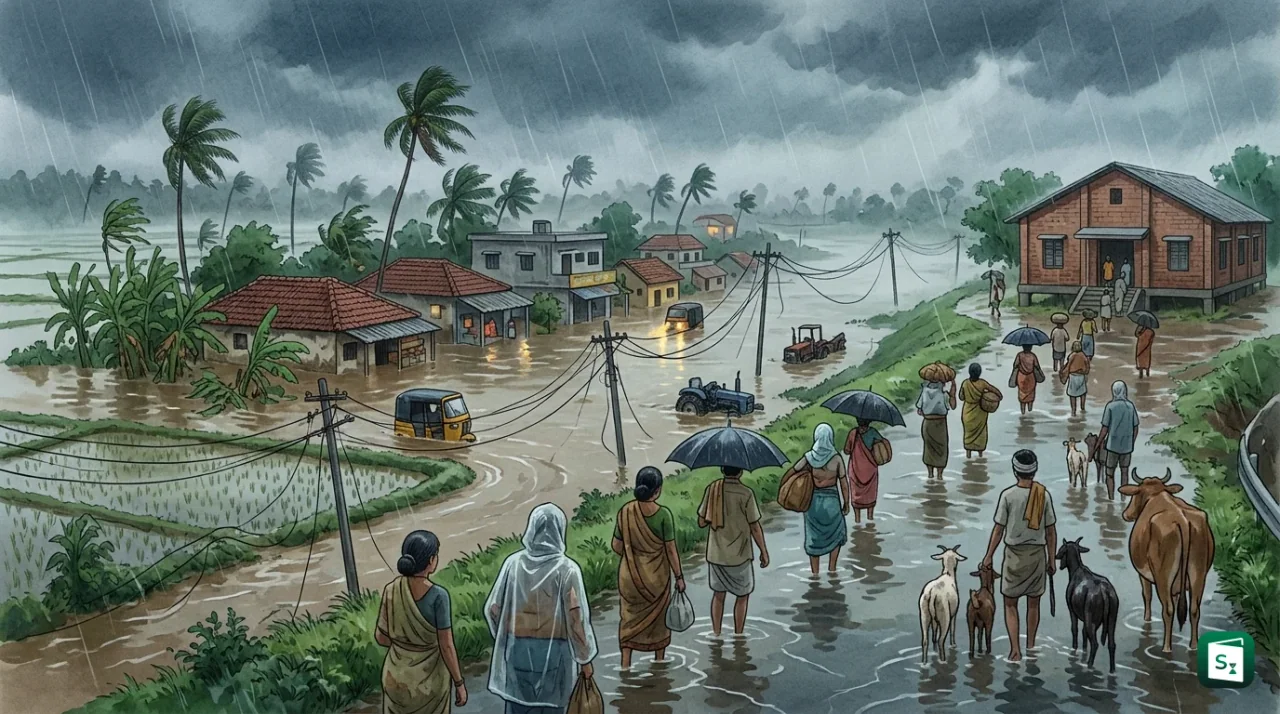
Severe Cyclonic Storm Murasu crossed the south Andhra Pradesh coast between Nellore and Narsapur, close to Ongole in Prakasam district, during the night of 2 to 3 November 2026. The India Meteorological Department recorded maximum sustained winds of 100 to 110 kmph, gusting to 120 kmph, with a storm surge of 1 to 1.5 metres above normal tide. The system weakened as it moved inland but caused heavy rain, flooding of standing crops and damage to power lines across south coastal Andhra Pradesh.
Where and When Cyclone Murasu Made Landfall in Andhra Pradesh
The India Meteorological Department (IMD) reported that Cyclone Murasu crossed the south Andhra Pradesh coast between Nellore and Narsapur, close to Ongole in Prakasam district, during the night of 2 to 3 November 2026. The landfall process lasted from about 3.30 am to 8.30 am Indian Standard Time on 3 November. At landfall the centre was near latitude 15.53 degrees North and longitude 80.22 degrees East, about 40 km southwest of Bapatla, 80 km north northeast of Kavali and 120 km west southwest of Machilipatnam.
The storm moved north northwest at about 8 kmph after landfall. By 10.30 am on 3 November it lay about 30 km from Ongole and 100 km south southwest of Vijayawada. IMD Doppler Weather Radars at Machilipatnam and Visakhapatnam tracked the system continuously. The table below summarises the post landfall track.
| Date and Time in 2026 | Location | Intensity |
|---|---|---|
| 3 November, early morning | South Andhra coast near Ongole | Severe Cyclonic Storm, 100 to 110 kmph gusting to 120 kmph |
| 3 November, noon | Inland near Ongole and Bapatla | Cyclonic Storm, 80 to 90 kmph gusting to 100 kmph |
| 3 November, night | Coastal Andhra Pradesh | Deep Depression, 40 to 50 kmph gusting to 60 kmph |
| 4 November, morning | East Telangana and adjoining coastal Andhra | Depression, 25 to 35 kmph gusting to 45 kmph |
| 4 November, noon | East Telangana and adjoining coastal Andhra | Well Marked Low Pressure Area |
South coastal Andhra Pradesh bore the first impact. IMD warned of heavy to very heavy rain in Prakasam, Bapatla, Nellore, Guntur, Palnadu, NTR, Krishna and West Godavari districts, with extremely heavy rain at isolated places. A storm surge with peak height of 1 to 1.5 metres above normal tide flooded low lying coastal stretches for about two hours after landfall before receding.
How Cyclone Murasu Formed Over the Bay of Bengal
How does a cyclone form. A tropical cyclone forms when warm sea water of at least 27 degrees Celsius releases heat and moisture into the air, moist air rises and condenses into clouds, low pressure develops at the surface and surrounding winds spin inward due to Earth rotation while low vertical wind shear lets the tower grow vertically.
Murasu followed this pattern in the Bay of Bengal, which produces about four times more cyclones than the Arabian Sea because its waters are warmer and receive large river inflow. The sequence began as an upper air circulation over the Andaman Sea on 28 October 2026. It became a low pressure area over the South Andaman Sea on 29 October, a well marked low on 31 October and a depression on the same day. On 1 November it intensified into a deep depression about 700 km east of Chennai and then into a cyclonic storm about 560 km east of Chennai with winds of 65 to 75 kmph gusting to 85 kmph.
The storm moved west northwest under an upper tropospheric ridge and drew in warm moist air over south peninsular India. It became a severe cyclonic storm over the west central Bay of Bengal on the morning of 2 November. Murasu was the second cyclone to strike the region within a week after Cyclone Arnab, which had made landfall on the Andhra coast on 28 October. October to November is the second cyclone season in the North Indian Ocean, with November as the primary peak, so back to back systems in this window fit the normal seasonal pattern.
What Is the Meaning of Murasu and Who Named the Cyclone
Murasu is a Tamil word that means drum. It refers to the traditional war drum that rulers used in ancient times to make public announcements and to warn people about danger, including natural calamities.
The name was proposed by India. The India Meteorological Department announced on 1 November 2026 that the deep depression over the southwest and adjoining west central Bay of Bengal had intensified into Cyclonic Storm Murasu. Officials of the Chennai centre had suggested ocean related and communication related Tamil names, and Murasu was selected because it is short, easy to pronounce and linked to the idea of information and warning. After Arnab, which was proposed by Bangladesh, Murasu was next in sequence, so the new system received this name. The next name in the list after Murasu is Akvan, proposed by Iran.
How Cyclones Are Named in the North Indian Ocean
Cyclones over the Bay of Bengal and the Arabian Sea are named from a pre agreed list maintained under the regional arrangement coordinated by the World Meteorological Organization and the Economic and Social Commission for Asia and the Pacific. The body is called the WMO/ESCAP Panel on Tropical Cyclones. It has 13 member countries: Bangladesh, India, Iran, Maldives, Myanmar, Oman, Pakistan, Qatar, Saudi Arabia, Sri Lanka, Thailand, the United Arab Emirates and Yemen.
The naming practice for the North Indian Ocean started in September 2004. The Regional Specialised Meteorological Centre in New Delhi, which functions inside the India Meteorological Department, assigns the name once a system reaches cyclonic storm strength. Names are used in sequence column by column, and each name is used only once before the list moves forward.
Proposed names must be short, easy to pronounce, culturally neutral and inoffensive to any community. They must not relate to politics, religion or gender, must not have cruel meaning and must not hurt sentiments. The maximum length is eight letters, and pronunciation guidance is filed with each suggestion. This system helps agencies, media and disaster managers identify a storm quickly and issue clear warnings when more than one system is active.
Cyclone Versus Depression and How IMD Classifies Storms
What is the difference between a cyclone and a depression. A depression is an early low pressure stage with maximum sustained winds of 31 to 49 kmph, while a deep depression has winds of 50 to 61 kmph and a cyclonic storm has winds of 62 to 88 kmph. Only a system that reaches cyclonic storm strength gets a name, and further growth creates severe and very severe stages.
The India Meteorological Department uses maximum sustained surface wind averaged over three minutes to classify low pressure systems in the Bay of Bengal and the Arabian Sea. The table below gives the full scale adopted from the World Meteorological Organization.
| System | Maximum Sustained Wind |
|---|---|
| Low Pressure Area | Less than 31 kmph |
| Depression | 31 to 49 kmph |
| Deep Depression | 50 to 61 kmph |
| Cyclonic Storm | 62 to 88 kmph |
| Severe Cyclonic Storm | 89 to 117 kmph |
| Very Severe Cyclonic Storm | 118 to 166 kmph |
| Extremely Severe Cyclonic Storm | 167 to 221 kmph |
| Super Cyclonic Storm | 222 kmph and above |
Murasu reached the severe cyclonic storm stage with 100 to 110 kmph winds. Landfall means the moment when the centre or eye of the storm crosses from sea to land. Heavy rain, strong winds and surge often continue for many hours after this moment because the system carries huge moisture inland as it weakens. That is why IMD issues separate cyclone alerts, cyclone warnings and heavy rain alerts even after the eye has crossed the coast.
What Happened After Landfall: Inland Flooding, Crop Damage and Infrastructure Impact
What happens after cyclone landfall. The storm loses energy from the sea but its clouds still hold huge moisture, so heavy rain, river swelling, waterlogging of fields and snapping of power lines continue inland for 12 to 24 hours. Low lying areas flood first, standing crops flatten under water and roads get blocked by fallen trees.
South coastal Andhra Pradesh showed this pattern clearly. Prakasam and Bapatla districts received about 200 mm of rain between midnight and 6 am on 3 November. Marripalem in Palnadu district recorded 263.75 mm in a single day, the highest in the state that day, followed by Ganapavaram with 246.7 mm and Konanki in Bapatla district with 213.25 mm. Five stations recorded extremely heavy rain above 204.5 mm, and 21 stations recorded more than 100 mm. The Budameru rivulet in NTR district, which had caused floods in Vijayawada in 2024, received heavy inflow, so people in low lying areas were shifted to relief centres.
Standing paddy, cotton, maize, black gram, pigeon pea and chilli crops were submerged. The first state assessment reported damage over 52,459 hectares, damage to 312 houses and a preliminary loss of about ₹344 crore. A later detailed enumeration for Murasu alone put agricultural damage at about 1,33,351 hectares across nine districts affecting 1,86,269 farmers, with production loss of about 3,38,302 tonnes. Horticultural crops were damaged over about 6,748 hectares in 530 villages. Guntur, Bapatla and Palnadu were the worst hit, with about 12,230 people housed in rehabilitation centres in these districts in the first phase.
Infrastructure damage spread quickly. More than 300 trees were uprooted across eight villages in Prakasam district, with 30 trees falling on roads. Around 90 power poles were damaged in Naguluppalapadu alone, and more than 200 mobile towers of one service provider were affected. More than 35 trains were cancelled, 14 were diverted and eight were rescheduled. Some flights were cancelled, schools were closed and fishing boats were wrecked along the coast. Two rain related deaths were reported from Bapatla district in the first bulletin after buildings collapsed in Chinnaganjam and Karamchedu, and the state toll later rose to four.
Coastal Andhra districts that faced the heaviest impact were Nellore, Prakasam, Bapatla, Guntur, Krishna, NTR and Palnadu. The neighbouring areas of south Odisha, Tamil Nadu, Puducherry, Telangana and Chhattisgarh also received heavy rain as the remnant moved northwest. The state government noted that damage from Murasu was less than the damage from Cyclone Arnab a week earlier, but the two storms together damaged agricultural crops on 4,61,194 hectares and horticultural crops on 29,960 hectares in Andhra Pradesh.
How Andhra Pradesh Responded to Cyclone Murasu
The Andhra Pradesh State Disaster Management Authority started evacuation on 2 November after IMD and real time governance forecasts showed the track toward Ongole and Bapatla. About 2,000 people from vulnerable coastal pockets were moved on the first evening, with plans to move about 30,000 people to safe shelters. Eight mandals in Prakasam district were placed under precautionary cover, and 137 pregnant women due for delivery within ten days were shifted to hospitals where ten deliveries took place safely.
The state government released ₹37 crore to 17 districts for rescue and emergency response through order G.O. Rt. No. 120 dated 2 November. Six districts including Nellore, Prakasam, Bapatla, Guntur, Krishna and Markapuram received ₹3 crore each. Collectors used the funds for shelters, drinking water, food, medical camps, sanitation and emergency power. Government schools and colleges served as shelters where needed, and buses were arranged for transport.
Chief Minister N. Chandrababu Naidu reviewed the storm at 3.30 am on 3 November with collectors and later sought interim central assistance. The state placed the preliminary Murasu loss at ₹1,919.59 crore, with crops damaged across about 1,43,122 hectares affecting about 1,86,063 farmers in the interim note to the Union Home Ministry. Union Home Minister Amit Shah assured support and said National Disaster Response Force and State Disaster Response Force teams were on the ground. By 7 November the Chief Minister reported that power had been restored in most villages, essential commodities had reached 3.82 lakh families and enumeration of horticultural loss was 92 percent complete.
Key Takeaways
- Severe Cyclonic Storm Murasu crossed the south Andhra Pradesh coast near Ongole between Nellore and Narsapur on 3 November 2026 with winds of 100 to 110 kmph gusting to 120 kmph.
- The name Murasu, meaning drum in Tamil, was proposed by India and refers to the traditional war drum used for public warning.
- Cyclone names for the Bay of Bengal and Arabian Sea are assigned by the RSMC New Delhi under the WMO/ESCAP Panel on Tropical Cyclones with 13 member countries, a practice in force since September 2004.
- Murasu weakened from a Severe Cyclonic Storm (89 to 117 kmph) to a cyclonic storm, deep depression and then a well marked low over east Telangana by 4 November, but caused extremely heavy rain up to 263.75 mm at Marripalem.
- Early state estimates reported crop damage over 52,459 hectares and losses of about ₹344 crore, with later enumeration placing Murasu agricultural damage at about 1,33,351 hectares across nine districts.