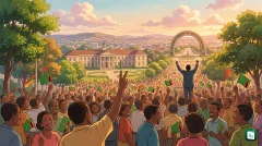
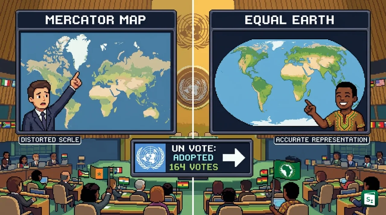
The United Nations General Assembly adopted the resolution titled Correct the Map on 4 September 2026 to promote a fairer and more accurate visual representation of the world. The resolution, introduced by Togo on behalf of the African Group, was passed by 164 votes in favour, 1 against and 6 abstentions. It urges governments, schools, international bodies and technology companies to use equal-area projections, especially the Equal Earth projection, wherever the relative size of continents matters.
What Did the UN General Assembly Adopt?
The resolution is formally titled Correct the Map: Rebalancing Global Cartographic Representation and Promoting Equitable Representation of the World’s Regions, Particularly Africa. It was circulated as document A/80/L.104 and adopted on 4 September 2026 during the 80th session of the United Nations General Assembly (UNGA). UNGA is the main deliberative body of the United Nations, headquartered in New York, where all 193 member states have one vote each.
The voting result was 164 votes in favour, 1 vote against and 6 abstentions. The United States was the only country to vote against the text. Estonia, Georgia, Lithuania, the Republic of Moldova, Serbia and Ukraine abstained. Supporters included a large cross regional majority, with France and the United Kingdom among those voting in favour.
The text does not ban the Mercator map and does not impose one compulsory world map. It recommends wider use of equal-area projections, particularly the Equal Earth projection, in education, public communication, media and institutional publications where comparison of land size is important. It also calls for teaching the limits of flat maps and for developing international standards for fair cartographic representation. Resolutions of the General Assembly adopted under Article 10 of the UN Charter are recommendations and are not legally binding on member states, unlike certain decisions of the UN Security Council. The resolution therefore creates political and moral pressure but no legal duty to change maps.
The resolution also makes clear that a change in projection does not change sovereignty, territory or borders. A map projection is only a mathematical method for showing the curved surface of the Earth on a flat surface. It does not decide boundary lines, place names or legal claims. This point was underlined after the vote, with clarification that implementation of the resolution neither affects internationally recognised borders nor implies recognition of any disputed territorial claim.
Why the Mercator Map Distorts the World
The Mercator projection is a method of drawing the round Earth on a flat sheet. It was created in 1569 by Gerardus Mercator, a Flemish geographer and cartographer. He designed it for sailors crossing oceans during the Age of Discovery. On his map, lines of latitude and longitude cross at right angles, and a route that follows a constant compass direction, called a rhumb line, appears as a straight line. This made navigation simpler and safer, and from the 18th century onwards the projection became the global standard for nautical charts.
The price of that navigational advantage is distortion of area. To keep local angles correct, the map stretches distances further away from the equator. Places near the poles therefore look far larger than they really are, while places near the equator look smaller. The effect grows sharply with latitude. A small patch of land at 60 degrees latitude takes about four times the map area of the same sized patch at the equator. At 80 degrees latitude, the factor rises to about 33 times.
This is why Africa, which straddles the equator with an area of about 30.37 million square km, looks roughly the same size as Greenland, which lies far to the north with an area of about 2.16 million square km, on a standard Mercator world map. In reality, Africa is about 14 times larger than Greenland. Africa is also larger than the United States, China, India, Japan, Mexico and much of Europe combined. The same distortion inflates the apparent size of Russia, Canada and Antarctica and shrinks Latin America, South Asia and Africa.
No flat map can avoid all distortion. A globe is the only fully accurate model of the Earth. Every flat projection must sacrifice something among area, shape, distance or direction. Mercator chose to preserve local shape and direction for sailors. That choice made sense for navigation but is misleading when the same map is used in classrooms, news graphics and mobile apps to compare the size or importance of countries.
What Is the Equal Earth Projection?
An equal-area projection is a type of map that shows all land areas in their correct relative proportion. A country that covers twice the real land of another country will also cover twice the area on the map. The Equal Earth projection is one such modern equal-area map. It was developed in 2018 by three cartographers, Bojan Savric, Tom Patterson and Bernhard Jenny, and described in the International Journal of Geographical Information Science.
The creators were responding to an earlier debate in Boston public schools, which in 2017 had adopted the older Gall-Peters projection to show true sizes. Gall-Peters is also equal-area, but it stretches polar shapes heavily and many readers find it visually harsh. Equal Earth was designed to keep true relative area while looking more natural and balanced. Its overall outline was inspired by the widely used Robinson projection, which is pleasing to the eye but does not preserve area.
On an Equal Earth map, parallels of latitude remain straight, which makes it easy to judge how far north or south a place lies. Meridians of longitude curve gently toward the edges, which gives an impression of the spherical Earth. Pole lines are shown as short lines rather than points, so the whole globe fits in a finite frame. Africa and Greenland return to their true ratio of about 14 to 1. The projection is defined as a pseudocylindrical projection, which means it uses straight parallels and curved meridians to balance shape and area.
Equal Earth is not free of distortion. It accepts some stretching of shapes and angles near the poles and at the far edges in exchange for correct area everywhere. It also cannot give correct long distances with a ruler. For those reasons, it is not meant to replace Mercator for sea and air navigation, where constant compass bearings remain essential. Its strength is in world maps used to compare land extent, forest cover, farmland, population distribution and other themes where area honesty matters.
| Feature | Mercator Projection | Equal Earth Projection |
|---|---|---|
| Year created | 1569 by Gerardus Mercator | 2018 by Savric, Patterson and Jenny |
| Main purpose | Navigation with straight compass routes | Fair comparison of relative land size |
| Area accuracy | No, inflates high latitudes | Yes, preserves relative area |
| Shape and direction | Preserves local angles | Distorts shapes near poles and edges |
| Poles on map | Cannot be shown, lines go to infinity | Shown as short finite lines |
| Best use | Nautical charts and web navigation | Classrooms, atlases, thematic world maps |
How Africa Led the Correct the Map Campaign
The UN vote was the culmination of an African led campaign that began outside government halls. In April 2025, two advocacy groups, Africa No Filter and Speak Up Africa, launched the Correct the Map campaign. It urged schools, media houses, international organisations and technology companies to drop Mercator as the default world view and adopt Equal Earth where size comparison matters. The campaigners argued that a map that visually shrinks Africa fosters an impression that the continent is marginal, even though Africa is the second largest continent and home to more than 1.4 billion people.
The African Union (AU) endorsed the campaign in August 2025. The AU is the continental body of 55 member states. It was launched in 2002 in Durban, South Africa, as the successor to the Organisation of African Unity, which was founded in 1963. Its secretariat, the African Union Commission, is headquartered in Addis Ababa, Ethiopia. The AU said the campaign fits its goal of reclaiming Africa’s rightful place on the global stage. In February 2026, AU member states backed Equal Earth as the preferred reference for showing true continental proportions.
Togo, a West African nation, then carried the initiative to New York on behalf of the African Group. Foreign Minister Robert Dussey led the negotiations on draft resolution A/80/L.104. He presented the issue as one of cognitive justice and memorial reparation, meaning the correction of a long standing visual bias inherited from the colonial era. His often repeated line was that a fair map does not change the geography of the world, it changes how the world is seen. Togo has said it plans to revise its own school geography materials by the end of the year and will press other governments, publishers and digital platforms to follow.
Support also came from beyond Africa. The Bahamas joined the sponsoring group, and Caribbean voices linked the issue to a wider rejection of symbols of dominance. The Chairperson of the African Union Commission, Mahmoud Ali Youssouf, welcomed the adoption and praised Togo and President Faure Essozimna Gnassingbe for building broad international backing.
Reactions, Objections and What Happens Next
The vote exposed clear political differences. The United States opposed the text and described it as an unsuitable use of Assembly time linked to a wider ideological agenda around reparations and cognitive justice. Togo responded that the initiative is not directed against any nation or cartographic tradition and that it respects the position of the United States. Togo added that it wishes to continue dialogue on implementation. Ukraine abstained for a different reason. It said it does not oppose the core principle of fair representation but objected to the specific Equal Earth base map in circulation because it shows parts of its territory under occupation in a manner it finds unacceptable.
The European Union, speaking through Ireland, supported the goal of accurate representation while stressing that the text applies only to the relative size of landmasses in education and awareness. It does not settle questions of sovereignty, delimitation or recognised borders. Existing UN rules on official maps and place names therefore remain in force.
In practical terms, change will be gradual. The World Bank has said it already uses Winkel-Tripel or Equal Earth for static maps and is phasing out Mercator on web maps. Major web platforms moved earlier in part, with Google Maps shifting desktop views to a 3D globe in 2018 while retaining Mercator as an option. Schools, publishers and newsrooms will now face the choice of when to use which projection. Mercator will stay fully valid for marine and aerial navigation, for which the resolution expressly preserves its role.
For classrooms, the significance lies in geographic literacy. Students who learn that the Democratic Republic of the Congo, at about 2.34 million square km, is larger than Greenland, or that Africa can contain the United States, China, India and large parts of Europe, gain a more accurate sense of resources, population and economic potential. Over time, supporters expect updated textbooks, revised wall maps and new default settings in digital tools. Critics caution that no single flat map is perfect, and that map literacy must include the lesson that every projection involves a trade off.
Key Takeaways
- The UN General Assembly adopted the Correct the Map resolution (A/80/L.104) on 4 September 2026 by 164 votes to 1, with 6 abstentions.
- The resolution was introduced by Togo on behalf of the African Group and backed by the African Union to promote the Equal Earth projection.
- The Mercator projection was created in 1569 by Gerardus Mercator for navigation using straight rhumb lines, but it inflates high latitude lands.
- In reality, Africa (about 30.37 million square km) is about 14 times larger than Greenland (about 2.16 million square km).
- The Equal Earth projection was developed in 2018 by Bojan Savric, Tom Patterson and Bernhard Jenny as an equal-area alternative that preserves relative size.