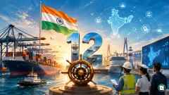
World Hydrography Day was observed globally on June 21, 2026, with the theme “Transforming how ocean data is shared”, drawing attention to a sweeping digital overhaul in how the world’s seas are charted and navigated. Organised by the International Hydrographic Organization (IHO), the day highlights the work of hydrographers and the critical role of hydrography in maritime safety, environmental protection, and economic development. The 2026 theme specifically focuses on the global transition to S-100 based data services, a next-generation framework designed to make ocean data more interoperable, accessible, and dynamic.
What Is Hydrography?
Hydrography is the branch of applied science that deals with the measurement and description of the physical features of oceans, seas, coastal areas, lakes, and rivers. It involves measuring water depths, mapping the shape of the seafloor, tracking tides and currents, and identifying underwater obstructions such as shipwrecks and rocks. The primary purpose of hydrography is to ensure the safety of navigation, but its applications extend far beyond that.
Hydrographic data underpins a wide range of marine activities, including offshore energy exploration, fishing and mineral resource exploitation, coastal zone management, environmental protection, maritime boundary delimitation, and scientific research into oceanography and climate change. The data is collected using specialised equipment such as multibeam echo sounders, side-scan sonar, and airborne lidar bathymetry deployed from survey ships, aircraft, and increasingly autonomous underwater vehicles. The professionals who conduct this work are known as hydrographers.
The importance of hydrography was formally recognised by the International Maritime Organization (IMO) under Chapter V, Regulation 9 of the Safety of Life at Sea (SOLAS) Convention, which requires contracting governments to provide and maintain adequate hydrographic services and products. Given that more than 90% of global trade by volume is carried by sea, accurate and up-to-date nautical charts are essential for the safe and efficient movement of ships worldwide.
The International Hydrographic Organization (IHO)
The International Hydrographic Organization (IHO) is the intergovernmental body responsible for coordinating the world’s hydrographic activities. It was originally established on June 21, 1921 as the International Hydrographic Bureau (IHB) in Monaco, following the First International Hydrographic Conference held in London in 1919, which was attended by hydrographers from 24 nations. The organisation was renamed the International Hydrographic Organization (IHO) in 1970 when a new convention on the IHO came into force. Its permanent secretariat, now called the IHO Secretariat, is headquartered in Monaco.
The IHO has 103 member states as of 2026, including India. It enjoys observer status at the United Nations, where it is recognised as the competent authority on hydrographic surveying and nautical charting. The organisation’s principal aim is to ensure that the world’s seas, oceans, and navigable waters are properly surveyed and charted. It achieves this through setting international standards, coordinating the work of national hydrographic offices, and running capacity building programmes.
Some of the IHO’s most significant contributions include the development of the S-57 standard for digital hydrographic data and the newer S-100 Universal Hydrographic Data Model, which is at the heart of the 2026 World Hydrography Day theme. The IHO also oversees standards for Electronic Navigational Charts (ENCs) and Electronic Chart Display and Information Systems (ECDIS), which have become mandatory for international shipping under SOLAS.
The 2026 Theme: Transforming How Ocean Data Is Shared
The theme “Transforming how ocean data is shared” was chosen by IHO member states to highlight the ongoing global transition to S-100 based data services. At its core, this theme is about moving away from static, paper style nautical charts towards a dynamic, digital ecosystem where ocean data can be updated, shared, and integrated in real time.
What Is the S-100 Framework?
The S-100 Universal Hydrographic Data Model is a next-generation data standard developed by the IHO. Unlike the older S-57 standard, which was designed specifically for electronic navigational charts and could not easily accommodate new types of data, S-100 is a flexible framework aligned with modern international geospatial standards, particularly the ISO 19000 series. This alignment allows hydrographic data to be integrated much more easily with broader geographic information systems.
The S-100 framework supports a suite of product specifications, each serving a specific navigational or maritime purpose:
| Product | Specification | Purpose |
|---|---|---|
| S-101 | Electronic Navigational Chart | Base navigation layer with improved display and usability |
| S-102 | Bathymetric Surface | High resolution seafloor depth data |
| S-104 | Water Level Information | Real time tidal and water level data |
| S-111 | Surface Currents | Dynamic current information for route planning |
| S-124 | Navigational Warnings | Digital warnings replacing text based messages |
| S-129 | Under Keel Clearance Management | Calculated clearance for deep draught vessels |
These products can be layered together and displayed on a single screen, giving mariners a much richer and more accurate picture of the maritime environment. For example, a ship entering a port can simultaneously view the electronic chart, real time tidal data, surface current information, and under keel clearance warnings all in one integrated display.
The S-100 framework also uses machine readable catalogues that enable plug and play systems. This means that as new data types and standards are developed, they can be added to the ecosystem without requiring a complete overhaul of existing navigation systems. The framework also includes a robust security scheme to protect the integrity and authenticity of data transmitted across the network.
The transition to S-100 is being implemented in phases. The IMO has approved the use of S-100 ECDIS as a regular means of navigation for international shipping, and the phased rollout began in 2026. The International Association of Marine Aids to Navigation and Lighthouse Authorities (IALA) and the World Meteorological Organization (WMO) are also collaborating with the IHO to incorporate their services into the S-100 ecosystem, including the S-411 ice information, S-412 weather data, and the S-20X suite of marine aids to navigation products.
India’s Hydrographic Capabilities
India has been an active and influential member of the IHO since 1955. The country’s hydrographic activities are managed by the Indian Naval Hydrographic Department (INHD), which functions under the Chief Hydrographer to the Government of India. The department serves as the nodal agency for hydrographic surveys and nautical charting in India and is headquartered at the National Hydrographic Office (NHO) in Dehradun, Uttarakhand.
The origins of organised hydrography in India date back to the Marine Survey of India, established in 1874 in Calcutta during British rule. After independence, the department was reorganised and the office was shifted to Dehradun, initially as the Naval Hydrographic Office. It was renamed the National Hydrographic Office in 1997 to reflect India’s growing international role in hydrography. The present Chief Hydrographer to the Government of India is Vice Admiral Lochan Singh Pathania.
The INHD operates a fleet of eight indigenously built survey ships equipped with state-of-the-art multibeam echo sounders and survey equipment, with two additional ships being constructed. It also runs the National Institute of Hydrography (NIH) in Goa, which provides IHO recognised CAT ‘A’ and CAT ‘B’ certification courses in hydrography to both Indian and international personnel. The institute is one of the few in the world to offer these recognised programmes.
India also serves as the NAVAREA VIII coordinator, responsible for disseminating maritime safety information and navigational warnings to shipping in the region covering the Indian Ocean. The country has signed memoranda of understanding with several friendly foreign nations for conducting joint hydrographic surveys and capacity building, and has trained personnel from 39 countries in hydrography. These efforts align with India’s broader MAHASAGAR vision for maritime cooperation in the Indian Ocean Region.
World Hydrography Day: History and Observance
The concept of a dedicated day to celebrate hydrography was adopted by the IHO in 2005, and the United Nations General Assembly welcomed it through Resolution A/RES/60/30 on Oceans and the Law of the Sea on November 29, 2005. The date June 21 was chosen because it marks the anniversary of the founding of the International Hydrographic Organization on June 21, 1921. The first World Hydrography Day was celebrated in 2006.
The purpose of the day, as stated by the UN, is to give suitable publicity to the IHO’s work at all levels and to increase the coverage of hydrographic information on a global basis. Each year, IHO member states agree on a theme that guides activities, events, and outreach programmes around the world. These activities include conferences, seminars, workshops, public exhibitions, ship tours, award ceremonies, and social media campaigns.
Previous Themes
| Year | Theme |
|---|---|
| 2007 | Electronic Navigational Charts (ENCs): An Essential Element of Safety at Sea |
| 2008 | Capacity Building: A Vital Tool to Assist the IHO in Achieving Its Mission |
| 2009 | Hydrography: Protecting the Marine Environment |
| 2010 | Hydrographic Services: The Essential Element for Maritime Trade |
| 2011 | Human Resources: The Important Element to the Success of Hydrography |
| 2012 | International Hydrographic Cooperation: Supporting Safe Navigation |
| 2013 | Hydrography: Underpinning the Blue Economy |
| 2014 | Hydrography: Much More Than Just Nautical Charts |
| 2015 | Our Seas and Waterways: Yet to Be Fully Charted and Explored |
| 2016 | Hydrography: The Key to Well Managed Seas and Waterways |
| 2017 | Mapping Our Seas, Oceans and Waterways: More Important Than Ever |
| 2018 | Bathymetry: The Foundation for Sustainable Seas, Oceans and Waterways |
| 2019 | Hydrographic Information Driving Marine Knowledge |
| 2020 | Hydrography Enabling Autonomous Technologies |
| 2021 | 100 Years of International Cooperation in Hydrography |
| 2022 | Hydrography: Contributing to the United Nations Ocean Decade |
| 2023 | Hydrography: Supporting the United Nations Ocean Decade |
| 2024 | Hydrographic Information: Enhancing Safety, Efficiency and Sustainability in Marine Activities |
| 2025 | Seabed Mapping: Enabling Ocean Action |
| 2026 | Transforming How Ocean Data Is Shared |
On World Hydrography Day 2026, several member states and organisations held events. The UK Hydrographic Office (UKHO) hosted a webinar on the S-100 transition with panelists from the Maritime and Coastguard Agency and General Lighthouse Authorities. Nigeria held a conference in Lagos with technical sessions on ocean data sharing and Blue Economy integration. The IHO also announced the winner of the Ex Abyssis ad Alta IHO Award for 2026. Australia, through the Australasian Hydrographic Society, held its annual gathering in Wollongong.
Key Takeaways
- World Hydrography Day is observed on June 21 every year, first celebrated in 2006, following the UN General Assembly Resolution A/RES/60/30 adopted on November 29, 2005.
- The International Hydrographic Organization (IHO) was founded on June 21, 1921 as the International Hydrographic Bureau and is headquartered in Monaco, with 103 member states as of 2026.
- Hydrography is the science of measuring and describing the physical features of water bodies, primarily for safe navigation, and is mandated under SOLAS Chapter V, Regulation 9.
- The 2026 theme “Transforming how ocean data is shared” focuses on the global transition to the S-100 Universal Hydrographic Data Model, a next generation framework for interoperable, real time digital ocean data.
- The S-100 framework supports multiple product specifications including S-101 (Electronic Navigational Charts), S-102 (Bathymetric Surface), S-104 (Water Level), and S-111 (Surface Currents), among others.
- India’s hydrography is managed by the Indian Naval Hydrographic Department (INHD) under the Chief Hydrographer to the Government of India, headquartered at the National Hydrographic Office in Dehradun.
- India operates eight survey ships and runs the National Institute of Hydrography in Goa, which offers IHO recognised CAT ‘A’ and CAT ‘B’ certification courses, and has trained personnel from 39 countries.