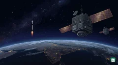


The Birla Institute of Technology (BIT) Mesra and the North Eastern Space Applications Centre (NESAC) have signed a Memorandum of Understanding (MoU) to strengthen collaboration in geospatial technologies and higher education. Valid for five years, this partnership focuses on advanced fields like Geospatial Artificial Intelligence (GeoAI) and remote sensing to drive research excellence. This initiative is expected to enhance India’s capabilities in Earth observation while providing students from the North East with better access to specialized space education.
Strengthening Geospatial Research and Education
The collaboration between BIT Mesra and NESAC is designed to bridge the gap between academic research and practical space applications. A primary focus of the MoU is the integration of Geospatial Artificial Intelligence (GeoAI) into higher education. GeoAI combines traditional geographic data with machine learning and deep learning techniques to automate the analysis of satellite imagery and environmental data.
As part of the agreement, both institutions will participate in the joint supervision of Master’s and PhD research scholars. This will allow students at BIT Mesra to work on real-world problems using NESAC’s extensive satellite databases. Additionally, NESAC scientists will be empaneled as guest faculty at BIT Mesra, while NESAC personnel will have opportunities to pursue part-time doctoral degrees at the institute.
Resource Sharing and Capacity Building
To facilitate high-quality research, NESAC will provide BIT Mesra with access to critical geospatial databases, satellite imagery, and meteorological datasets. This data is essential for modeling complex phenomena such as climate change, urban growth, and agricultural health. The access to high-resolution Earth observation data will enable researchers to develop more accurate predictive models using GeoAI tools.
Both organizations have also committed to organizing joint seminars, workshops, and training programs. These initiatives will focus on emerging technologies such as satellite navigation, GIS, and advanced image processing. By conducting regular technical sessions, the partnership aims to create a skilled workforce capable of handling India’s growing demands in the space sector and digital governance.
About the North Eastern Space Applications Centre (NESAC)
The North Eastern Space Applications Centre (NESAC) was established on 5 September 2000 as a joint initiative of the Department of Space (DoS) and the North Eastern Council (NEC). It is headquartered at Umiam, Meghalaya, and serves as a regional hub for leveraging space technology to support the development of India’s eight North Eastern states.
NESAC plays a critical role in regional governance by providing space-based inputs for natural resource management and infrastructure planning. It also operates a Flood Early Warning System (FLEWS) and provides satellite-based disaster management support for floods, landslides, and forest fires. The centre is headed by a Director and is a key implementation agency for the Department of Space in the North East.
BIT Mesra: A Pioneer in Space Research
The Birla Institute of Technology (BIT) Mesra, located in Ranchi, Jharkhand, was established in 1955. It has a long history of excellence in space and aeronautical sciences. In 1964, it became the first technical institute in India to establish a Department of Space Engineering and Rocketry, which has since produced several leading scientists for ISRO and other global space agencies.
BIT Mesra established its Department of Remote Sensing in 1997 to address the growing demand for professionals in satellite navigation and resource mapping. The department is recognized as a center of excellence and is supported by the Department of Science and Technology (DST) under the FIST programme. This deep institutional history makes BIT Mesra an ideal academic partner for NESAC in advancing geospatial research.
Significance for the North Eastern Region
The partnership is strategically important for the North Eastern Region (NER), which faces unique geographic challenges including rugged terrain and vulnerability to cloudbursts and landslides. By applying GeoAI to high-resolution satellite data, researchers can develop better disaster management tools and infrastructure monitoring systems. This aligns with the central government’s Act East policy, which emphasizes the sustainable development of the North East through technological integration.
Furthermore, the collaboration will help in creating a specialized talent pool within the region. By facilitating joint research and providing access to high-end space technology, the MoU ensures that students and scientists in the North East can contribute to national-level projects such as PM GatiShakti and the SVAMITVA scheme for land mapping. This will ultimately lead to better resource management and more resilient urban planning in the Eight Sister states.
Key Takeaways
- BIT Mesra and NESAC signed a five-year MoU to collaborate on Geospatial Artificial Intelligence (GeoAI) and remote sensing.
- The North Eastern Space Applications Centre (NESAC), established in 2000, is a joint initiative of the Department of Space and the North Eastern Council.
- NESAC is headquartered in Umiam, Meghalaya, and serves as a hub for space technology in the North Eastern Region.
- BIT Mesra established India’s first Department of Space Engineering and Rocketry in 1964.
- The collaboration includes the joint supervision of PhD scholars and the development of specialized elective courses in geospatial technologies.
- The MoU aims to support national initiatives like PM GatiShakti and enhance disaster management in the North East.