

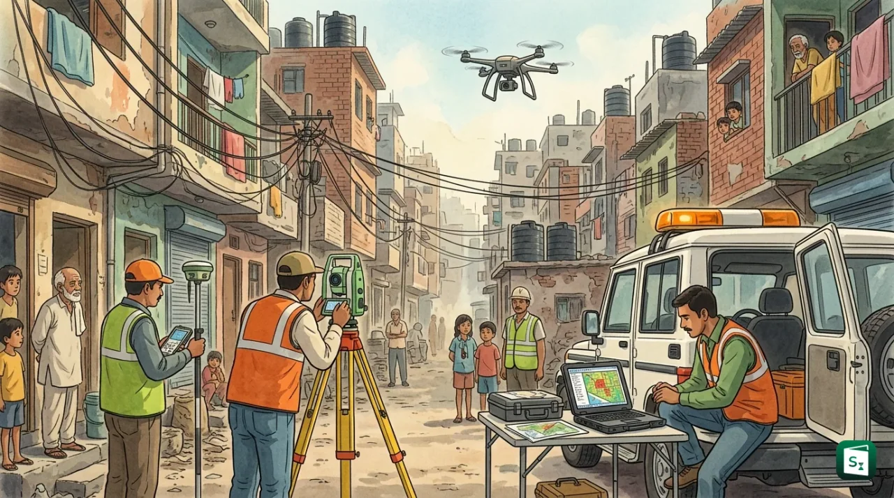
The central government has approved the ₹65 crore DRISHTI project to build a modern geospatial survey and mapping system for Delhi’s unauthorised colonies. The Delhi Revenue and Imaging Survey, Spatial Technology Initiative (DRISHTI) is designed to speed up the grant of property rights to residents under the Pradhan Mantri-Unauthorized Colonies in Delhi Awas Adhikar Yojana (PM-UDAY). The project will set up dedicated PM-UDAY cells in all 13 districts of Delhi and a branch at the Revenue Department headquarters, giving a technology-driven push to a scheme that has moved slowly since its launch in 2019.
What Is the PM-UDAY Scheme?
The Pradhan Mantri-Unauthorized Colonies in Delhi Awas Adhikar Yojana (PM-UDAY) is a central scheme launched in 2019 that grants ownership, transfer and mortgage rights to residents of notified unauthorised colonies in Delhi. It operates under the National Capital Territory of Delhi (Recognition of Property Rights of Residents in Unauthorized Colonies) Regulations, 2019.
The Union Cabinet approved the scheme on 23 October 2019, and the regulations were notified on 29 October 2019, with the supporting law following in December 2019. The scheme was designed by the Ministry of Housing and Urban Affairs (MoHUA) to solve a decades-old problem. For nearly 25 years, residents of these colonies held their homes through informal papers such as a General Power of Attorney, a Will, an Agreement to Sell, and payment or possession receipts. Because these documents were never registered at a Sub-Registrar’s office, the residents had no firm legal title.
PM-UDAY changes this by issuing formal title documents, mainly a Conveyance Deed (CD) or an Authorization Slip (AS). Once a resident receives these papers, several doors open. Homeowners can sell or purchase their property without legal hindrance, mortgage it to secure bank loans, and apply for approval of building plans. The scheme also exempts residents from a specific income tax liability on property purchases, which previously arose because many homes were bought below the government’s circle rate.
What Is the DRISHTI Project?
The Delhi Revenue and Imaging Survey, Spatial Technology Initiative (DRISHTI) is a ₹65 crore project to build a GIS-based survey and mapping system for Delhi’s unauthorised colonies. It verifies property boundaries and geo-coordinates under PM-UDAY through dedicated cells in all 13 districts, making identification, survey and documentation of properties more systematic and time-bound.
The Centre approved the project after the Delhi Chief Minister wrote to the Union Housing and Urban Affairs Minister seeking assistance to regularise unauthorised colonies. Under DRISHTI, every property in a notified colony will be linked to a digital map along with its survey and ownership details. This gives officials a spatial record to verify applications, spot overlapping boundary claims, and track the progress of each case.
How the ₹65 Crore Funding Is Structured
The project follows a shared funding model. The larger share comes as a central grant, while the Delhi government’s Revenue Department contributes the rest and remains the implementing agency for the project.
| Component | Amount | Share |
|---|---|---|
| Total project cost | ₹65 crore | 100% |
| Grant from Urban Development Fund (MoHUA) | ₹52 crore | 80% |
| Delhi Revenue Department contribution | ₹13 crore | 20% |
The ₹52 crore grant from the Urban Development Fund (UDF) will be released in four instalments. However, if the procurement is carried out through the Government e-Marketplace (GeM), the entire approved amount may be released in a single instalment, subject to prescribed conditions. The UDF, established in 1994, is a Delhi-specific pool managed through the Ministry of Housing and Urban Affairs to fund urban infrastructure.
Why Does Delhi Need a GIS Survey for Property Rights?
A Geographic Information System (GIS) is a computer-based tool that captures, stores and displays location-linked data on digital maps. In PM-UDAY, a GIS survey measures each property, records its geo-coordinates and boundaries, and certifies them, so that ownership can be verified against a reliable map instead of informal sketches and manual records.
Without an accurate map, it is difficult to confirm where one property ends and another begins. Unauthorised colonies were built without approved layout plans, and many plots have changed hands through unregistered agreements. This creates overlapping claims and disputes that slow down property rights. A GIS survey fixes a property’s position on a common spatial grid, which makes verification objective and reduces the scope for errors or manipulation.
Earlier, PM-UDAY relied on a small set of empanelled GIS agencies to conduct surveys for individual applicants. These agencies took GPS readings of plot corners, prepared scaled key-plans, and uploaded the data on the PM-UDAY portal, which generated a GIS ID and a QR code for the property. The new DRISHTI system will build on this practice by creating a permanent, state-run mapping infrastructure rather than depending on scattered private surveys.
The technical work is handled with high precision. The Delhi government’s Geospatial Delhi Limited (GSDL) conducts drone surveys and prepares digital maps for the Revenue Department. GSDL, formed in 2008 as a special purpose vehicle, is a Government of NCT of Delhi company that provides GIS, remote sensing and mapping services to several departments.
How Many Unauthorised Colonies Are in Delhi?
Delhi has 1,731 notified unauthorised colonies covered by the PM-UDAY Regulations of 2019. Of these, 1,511 colonies are being regularised under a 2026 gazette notification, with an estimated 44.7 lakh residents. The remaining colonies are either excluded or kept for a phased plan.
The original regulations of 2019 covered 1,731 colonies that existed as on 1 June 2014, provided they had at least 50 per cent built-up area as on 1 January 2015. In April 2026, the government moved a large step forward by clearing 1,511 of these colonies for regularisation on an “as is, where is” basis, with a cut-off date of 6 April 2026 for residential use.
Certain colonies were left out of this exercise. The regulations exclude 69 “affluent” unauthorised colonies, along with land that falls under protected or restricted categories.
| Excluded from PM-UDAY | Reason |
|---|---|
| Affluent unauthorised colonies (69) | Outside the scheme’s welfare scope |
| Reserved or notified forest land | Environmental protection |
| Monuments protected under the ASI Act, 1958 | Heritage protection |
| Zone-O of Master Plan Delhi 2021 | Land use restriction |
| Yamuna floodplain and ridge area | Ecological sensitivity |
| Right of way of existing roads and high-tension lines | Infrastructure safety |
The 2026 decision also removed a major hurdle: residents no longer need approved layout plans for regularisation, which had earlier held up applications for years.
Which Agencies Implement PM-UDAY?
PM-UDAY is implemented jointly by the Delhi Development Authority (DDA), the Delhi Government’s Revenue Department, and the Municipal Corporation of Delhi (MCD). Their responsibilities were reorganised in April 2026 to make the process faster and clearer.
The ownership side and the construction side are now handled by different bodies. The Revenue Department issues the title documents, meaning the Conveyance Deed or Authorization Slip that confirms ownership. The MCD handles the regularisation of built-up structures, a task earlier managed by the DDA. The DDA, which built and ran the PM-UDAY portal, is transferring that portal to the Delhi government.
| Agency | Role under PM-UDAY |
|---|---|
| Delhi Revenue Department | Issues Conveyance Deeds and Authorization Slips, implements DRISHTI |
| Municipal Corporation of Delhi (MCD) | Regularises existing built-up structures |
| Delhi Development Authority (DDA) | Prepared layout plans, runs the PM-UDAY portal |
| Geospatial Delhi Limited (GSDL) | Conducts drone and GIS surveys for the Revenue Department |
The DDA had earlier set up 10 processing centres and 17 extended offices across Delhi to scrutinise applications. Now, with DRISHTI, PM-UDAY cells will be established in all 13 districts along with a dedicated branch at the Revenue Department headquarters. This brings the process closer to applicants and reduces reliance on fragmented manual paperwork.
The 13 districts themselves are a recent creation. In December 2025, the Delhi Cabinet approved a reorganisation that raised the number of revenue districts from 11 to 13, carving out Old Delhi, Central North and Outer North and merging the former Shahdara district. The reorganisation, which took effect on 1 January 2026, aligned revenue boundaries with MCD zones, making it easier to coordinate payments, surveys and land-record work in the same area.
How Does the PM-UDAY Registration Process Work?
To apply for property rights under PM-UDAY, a resident registers on the PM-UDAY portal or mobile app, gets a GIS survey of the property done by an authorised agency, and uploads supporting documents. After departmental scrutiny and a field visit, the applicant pays the charges and receives the Conveyance Deed or Authorization Slip.
The process moves through a fixed sequence of steps. Each stage is recorded online, so applicants can track their case status at any point.
| Step | What Happens |
|---|---|
| 1. Registration | Applicant registers on the PM-UDAY portal or app and notes the GIS agency named on the receipt |
| 2. GIS survey | The agency measures the plot, records its geo-coordinates and issues a GIS ID |
| 3. Document upload | Applicant uploads proof of ownership, possession and payment, plus affidavits and bonds |
| 4. Pre-scrutiny | Officials check the application for eligibility |
| 5. Field verification | A survey team visits the property and records statements from neighbours or the local RWA |
| 6. Deficiency correction | Applicant fixes any shortfalls flagged in a Deficiency Memo |
| 7. Payment | Charges are calculated and the payment link is activated |
| 8. Execution | The Conveyance Deed or Authorization Slip is executed and later registered at the Sub-Registrar |
Applicants must submit a valid chain of documents. A registered Sale Deed or Gift Deed, or the latest set of General Power of Attorney with Agreement to Sell, is mandatory. For properties on government land, proof of construction before 1 January 2015 is required. An Indemnity Bond and a self-declaration are also needed.
Under the simplified 2026 framework, the government has announced clear timelines. Geospatial surveys are to be completed within seven days of an application, deficiencies addressed within 15 days, and Conveyance Deeds issued within 45 days.
The Bigger Push for Digital Land Records in Delhi
DRISHTI is one part of a wider effort to modernise land records in the national capital, where ownership data is currently split across several agencies. The Delhi government is preparing a Delhi Land Records Bill, 2026 to create one consolidated digital record of all properties in the city.
Under the proposed law, every property in Delhi will undergo a scientific survey and receive a unique “Property Aadhaar Card”, along with a Property Identification Number (PID). The record will extend to every floor of every building and cover residential, commercial and other categories of property.
The city is also building on the Centre’s SVAMITVA scheme, launched on 24 April 2020 and implemented by the Ministry of Panchayati Raj. SVAMITVA, which stands for Survey of Villages Abadi and Mapping with Improvised Technology in Village Areas, uses drone surveys and the Survey of India to issue property cards in rural areas. Delhi ran a pilot in 30 rural villages, creating authenticated property cards and demonstrating how survey technology can reduce land disputes.
| Feature | SVAMITVA | PM-UDAY |
|---|---|---|
| Area covered | Rural inhabited (abadi) areas | Urban unauthorised colonies in Delhi |
| Nodal body | Ministry of Panchayati Raj | Ministry of Housing and Urban Affairs |
| Document issued | Property Card | Conveyance Deed or Authorization Slip |
| Primary tool | Drone survey, CORS network | GIS survey, drone and imaging technology |
Registration and record-keeping are also going digital. Documents are now registered through the National Generic Document Registration System (NGDRS), which replaced Delhi’s older Delhi Online Registration Information System (DORIS). The government has also announced plans to give every land parcel a 14-digit Unique Land Parcel Identification Number (ULPIN), prepared using satellite imagery from the Survey of India.
Alongside these reforms, Delhi has allocated ₹800 crore in its 2026-27 budget to strengthen infrastructure such as roads, drains, sewerage and water supply in unauthorised colonies.
Challenges and the Way Forward
Progress under PM-UDAY has stayed modest despite repeated simplifications. Even after years of effort, only around 40,000 Conveyance Deeds or Authorization Slips had been issued against a target of granting ownership rights to more than 15 lakh property owners. In the building-regularisation component, the response was even slower in its early phase.
Several reasons explain this hesitancy. Many residents are deterred by the charges involved, while others face complications arising from multiple ownership of a single property. Lengthy documentation and uncertainty about boundaries add to the delay. To address cost concerns, the MCD approved a 75 per cent rebate on regularisation charges for constructions completed before April 2026, bringing the effective cost down substantially.
DRISHTI is meant to tackle the technical side of these problems. By creating a single digital map linked to ownership records, it can settle boundary disputes, cut down repeated physical verification, and make the process more transparent. Bringing the cells to the district level should also reduce the time applicants spend travelling between offices.
The larger goal is a city where every property has a verified digital identity. The Delhi Land Records Bill, the ULPIN system and DRISHTI together point in that direction. How quickly that goal is reached will depend on how many residents come forward and how smoothly the new district-level machinery delivers on its promised timelines.
Key Takeaways
- The Centre approved the DRISHTI project (Delhi Revenue and Imaging Survey, Spatial Technology Initiative) with an outlay of ₹65 crore to build a GIS-based survey and mapping system for Delhi’s unauthorised colonies.
- The project is funded 80 per cent by the Urban Development Fund of the Ministry of Housing and Urban Affairs (₹52 crore) and 20 per cent by the Delhi Revenue Department (₹13 crore).
- PM-UDAY cells will be set up in all 13 districts of Delhi along with a dedicated branch at the Revenue Department headquarters.
- PM-UDAY, launched in 2019, grants ownership, transfer and mortgage rights to residents of notified unauthorised colonies under the NCT of Delhi Regulations, 2019.
- Delhi has 1,731 notified unauthorised colonies, of which 1,511 are being regularised on an “as is, where is” basis with a cut-off date of 6 April 2026.
- The title documents issued under PM-UDAY are the Conveyance Deed and the Authorization Slip, executed by the DDA and later registered at a Sub-Registrar’s office.
- Geospatial Delhi Limited (GSDL), formed in 2008, provides drone and GIS survey support to the Delhi Revenue Department.
- Delhi increased its revenue districts from 11 to 13 with effect from 1 January 2026, aligning them with MCD zones.