

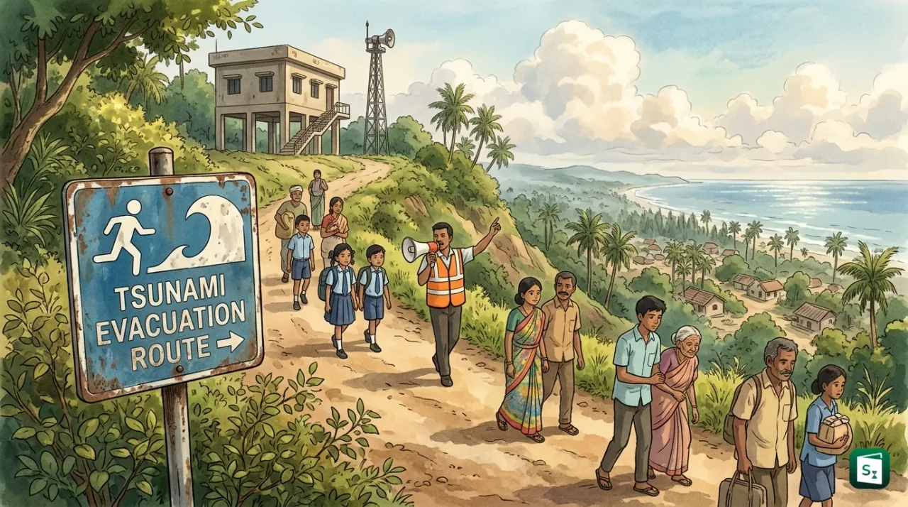
World Tsunami Awareness Day was observed on 5 November 2026 under the theme Be Tsunami Ready: Resilience Starts With You. The United Nations Office for Disaster Risk Reduction led the global call for individuals and communities to learn warning signs, practise evacuation and support vulnerable groups. The day holds special meaning for India, which lost more than 12,000 lives in the 2004 Indian Ocean tsunami.
When Is World Tsunami Awareness Day and What Is the 2026 Theme?
World Tsunami Awareness Day is observed every year on 5 November. The United Nations General Assembly declared the day in December 2015 through resolution 70/203, and the first observance took place in 2016. The United Nations Office for Disaster Risk Reduction (UNDRR) coordinates the global observance with support from the rest of the United Nations system.
The theme for 2026 is Be Tsunami Ready: Resilience Starts With You. The theme places responsibility on individuals and neighbourhoods rather than only on governments and machines. It asks every person in a coastal area to know the natural warning signs, know the local evacuation route, keep a household emergency plan ready, take part in community drills and help those who need extra support, including children, older persons, persons with disabilities, tourists and migrants.
The 2026 theme builds on the 2025 focus on investment in preparedness. It also supports three larger global efforts. The first is the Sendai Framework for Disaster Risk Reduction 2015 to 2030, the 15 year global agreement to cut disaster losses. The second is the Early Warnings for All initiative, launched by the United Nations Secretary General in 2022 with the goal that every person on earth is covered by an early warning system by 2027. The third is the expansion of the UNESCO-IOC Tsunami Ready recognition programme, which certifies coastal communities that meet strict preparedness standards. The global campaign also promotes the #GetToHighGround call, launched by UNDRR in 2022, which encourages people to walk or run along evacuation routes in drills.
What Is a Tsunami and How Is It Formed?
A tsunami is a series of powerful ocean waves caused by a sudden displacement of seawater. Most tsunamis follow strong, shallow undersea earthquakes that lift or drop the seafloor. Landslides, volcanic eruptions and meteorite impacts can also displace water and generate similar waves.
The word tsunami comes from the Japanese words tsu, meaning harbour, and nami, meaning wave. It is pronounced soo-NAH-mee. Scientists classify the tsunami as a natural disaster of geophysical origin. About 80 percent of known tsunamis are triggered by earthquakes.
Not every earthquake creates a tsunami. Three conditions raise the risk. The earthquake must be strong, usually of magnitude 6.5 or more. It must be shallow, generally less than 70 km below the surface. And it must move the seafloor up or down. Thrust earthquakes, in which one tectonic plate pushes over another along a subduction zone, are the most dangerous type for this reason.
Once formed, tsunami waves behave very differently from normal wind driven waves. In the deep ocean they travel at speeds of 700 to 800 km per hour, as fast as a jet plane, but their height may be less than one metre, so ships hardly notice them. As the water becomes shallow near the coast, the waves slow down and grow taller. They can reach heights of 10 to 30 metres in extreme cases and rush inland like a fast rising tide. The waves arrive in a series with gaps of 10 to 60 minutes and can continue for several hours. Strong currents, floating debris, erosion of foundations and the backwash that drags people and objects out to sea cause most deaths and damage.
| Feature | Tsunami | Wind Driven Wave | Tide |
|---|---|---|---|
| Cause | Undersea earthquake, landslide, volcanic eruption or impact that displaces seawater | Wind blowing over the ocean surface | Gravitational pull of the moon and sun |
| Speed in deep ocean | 700 to 800 km per hour | Up to about 90 km per hour | Slow, predictable rise and fall |
| Appearance near shore | Fast rising wall of water that floods far inland, in multiple waves | Single breaking waves that rise and fall quickly | Gradual rise and fall over about six hours |
| Warning time | Minutes to a few hours after the disturbance | Forecast through weather reports | Fully predictable years in advance |
A tsunami is often wrongly called a tidal wave. Ocean scientists discourage that name because tides play no part in forming a tsunami. A tsunami at high tide can cause more flooding, but the tide itself does not trigger it.
Tsunamis cannot be prevented, and their exact time and size cannot be predicted in advance like rainfall. However, modern warning systems can detect a large undersea earthquake within minutes and track changes in sea level through buoys and tide gauges. For distant coasts this gives valuable time to evacuate. For coasts very close to the source, waves can arrive within 10 to 20 minutes, before any official alert. That is why knowledge of natural warning signs is treated as the first line of defence.
Why 5 November Was Chosen: The Story of Inamura no Hi
The United Nations did not choose 5 November because it marks a tragedy. It chose the date because it marks a rescue. The story is known in Japan as Inamura no Hi, which means the burning of the rice sheaves.
On 5 November 1854, a powerful earthquake of magnitude 8.4, now called the Ansei Nankai Earthquake, struck off the Kii Peninsula in western Japan. The shaking was followed by a large tsunami that hit the small village of Hiromura, in present day Hirogawa town in Wakayama Prefecture. A farmer and village leader named Hamaguchi Goryo, who lived from 1820 to 1885, felt the earthquake and then noticed the sea pulling back and the level of water in wells falling fast. He understood that a tsunami was coming.
It was dusk and the village lay in darkness. Hamaguchi set fire to his own stacks of harvested rice, his entire crop for the year, on high ground. Villagers rushed uphill to put out the fire and reached safety before the waves arrived. From the hilltop they watched the tsunami destroy the homes below and understood that the fire had saved them.
Hamaguchi did more than save lives on that night. He spent his own funds to house survivors, supply food and hire villagers to build a protective embankment about 600 metres long and 5 metres high, along with planted trees as a buffer. That embankment later reduced damage when another major tsunami from the Showa Nankai Earthquake struck the same village in December 1946.
The tale later entered school lessons through teacher Nakai Tsunezo and through a short story called A Living God written in 1896 by writer Koizumi Yakumo, also known as Lafcadio Hearn. The town set up the Hall of the Fire of Rice Sheaves in 2007 to preserve the lesson that prompt evacuation saves lives. Japan also observes 5 November as its national Tsunami Preparedness Day under the Act on Promotion of Tsunami Countermeasures passed in 2011.
When Japan proposed a world day on tsunamis, 142 countries joined as co sponsors. The General Assembly adopted the proposal by consensus. The choice linked the new day to traditional and local knowledge rather than to mourning alone, and highlighted three ideas found in the story: protect lives first, rebuild better after loss and prepare before the next hazard.
The 2004 Indian Ocean Tsunami and Lessons for India
The modern push for tsunami readiness began with the Indian Ocean tsunami of 26 December 2004. A massive undersea earthquake of magnitude 9.1 struck off the coast of Sumatra in Indonesia. It lifted the seafloor and sent waves up to 30 metres high across the ocean at jet speed. About 14 countries around the Indian Ocean were hit, and more than 230,000 people died. In the past 100 years, 58 tsunamis have together claimed more than 260,000 lives, and the 2004 event caused the largest share of that toll.
India was among the worst affected countries. The Andaman and Nicobar Islands, closest to the source, were struck first. On the mainland, waves reached the coasts of Tamil Nadu, Puducherry, Kerala and Andhra Pradesh around 9:50 in the morning and pushed 300 metres to 3 km inland. In total, nearly 2,260 km of Indian coastline and 1,089 villages were affected.
| Impact in India, 2004 | Recorded figure |
|---|---|
| Lives lost | 12,405, including 8,009 in Tamil Nadu, 3,513 in Andaman and Nicobar Islands, 599 in Puducherry, 177 in Kerala and 107 in Andhra Pradesh |
| People affected | 27.92 lakh people across five states and island territories |
| Homes damaged or destroyed | More than 2.35 lakh dwelling units, about 1.9 lakh of them in Tamil Nadu |
| Boats damaged or lost | 83,788 boats, which wiped out income for fishing families |
| Cropped area damaged | 39,035 hectares, with seawater spoiling farmland |
| Estimated monetary damage | About ₹11,544.91 crore |
Within Tamil Nadu, Nagapattinam district suffered the most, with 6,051 deaths. Fishing hamlets within 100 to 200 metres of the sea bore the heaviest loss. Karaikal in Puducherry, Kanyakumari, Cuddalore and Chennai, including Marina Beach and the fishing harbour, also reported heavy casualties. In Kerala, Kollam and Alappuzha districts recorded the highest toll in the state. The Nicobar group of islands suffered near total destruction of homes, jetties, roads, power lines and coconut plantations.
Three weeks after the disaster, governments met in Kobe in the Hyogo region of Japan and adopted the 10 year Hyogo Framework for Action, the first comprehensive global agreement on disaster risk reduction. They also created the Indian Ocean Tsunami Warning and Mitigation System, with scores of seismic and sea level stations to share alerts across rim countries. The Hyogo Framework was later succeeded by the Sendai Framework in March 2015.
How India Tracks Tsunamis Today
India built its own warning shield in response to 2004. The Indian Tsunami Early Warning Centre (ITEWC) was set up at the Indian National Centre for Ocean Information Services (INCOIS) in Hyderabad. INCOIS functions under the Ministry of Earth Sciences and the centre has worked round the clock since October 2007.
The system combines real time seismic monitoring with sea level observations from tsunami buoys and tide gauges, along with computer models that estimate which coastal stretches face danger. The centre can detect a tsunamigenic earthquake in the Indian Ocean and in global oceans within 10 minutes of its occurrence and sends advisories to disaster officials through email, fax, SMS, the Global Telecommunication System and its website. INCOIS also acts as one of three Tsunami Service Providers for the Indian Ocean, along with centres in Australia and Indonesia, under the Intergovernmental Coordination Group for the Indian Ocean Tsunami Warning and Mitigation System of the Intergovernmental Oceanographic Commission of UNESCO.
Technology alone is not enough, so India joined the UNESCO-IOC Tsunami Ready programme. This is a performance based certification that tests whether a coastal village or town can act on a warning. Communities must meet a set of best practice indicators, including a risk reduction plan, mapped hazard and inundation zones, public display of tsunami information, clear evacuation maps, education material, at least three outreach activities each year, an annual drill, a community emergency plan and reliable round the clock means to spread official alerts.
A National Board chaired by the Director of INCOIS, with members from the Ministry of Earth Sciences, the National Disaster Management Authority (NDMA), the Ministry of Home Affairs and state bodies, guides the effort in India. Odisha State Disaster Management Authority (OSDMA) piloted the programme in six villages. Two of them, Venkatraipur in Ganjam district and Noliasahi in Jagatsinghpur district, were certified on 7 August 2020. With that step, India became the first country in the Indian Ocean region, and Odisha the first state, to earn international Tsunami Ready recognition.
The effort has since grown. In December 2024, 24 more villages across six coastal districts of Odisha earned the tag, while the certificates of the first two villages were renewed, taking the state total to 26 communities. The recognised villages include settlements in Kendrapara, Balasore, Bhadrak, Jagatsinghpur, Puri and Ganjam districts. INCOIS holds regular communication tests and joins the Indian Ocean wide IOWave mock exercises held every two years to check readiness. Plans aim to extend the programme to more than 400 villages in Odisha and Kerala by 2030, along with better inundation maps and warning for non seismic sources such as volcanic activity.
What Being Tsunami Ready Means for Individuals and Communities
The 2026 theme stresses a simple point. In many local tsunamis, waves can arrive before any official message. People themselves are the first responders. Safety therefore starts with three habits: learn the signs, practise the move and include everyone.
Natural warning signs need no equipment. A strong or long earthquake felt near the coast, a sudden and unusual rise or fall in sea water, and a loud roar from the ocean all signal danger. The rule is to move at once to high ground or far inland on foot, using known evacuation routes, and not to wait for an alert or go to the shore to watch the waves. A tsunami is a series of waves, so people should stay away from the coast for at least two to three hours after the first wave. Those already in a boat in deep water should stay offshore, where the waves pass harmlessly, rather than return to port.
Readiness at home and at work makes that quick move possible. Families are advised to agree on a meeting place, keep torch, battery radio, drinking water, food, medicines and sturdy shoes ready, and learn more than one escape path from home, school and workplace. Schools, hotels, shop owners and local leaders in coastal belts are encouraged to display hazard maps, mark routes clearly and join annual drills. The 2026 global call asks governments to organise evacuation drills during the week of 5 November, schools to add age suitable lessons on tsunamis, tourism operators to brief staff and guests, and community groups to shape clear messages for persons with disabilities, older persons and migrants so that no one is left behind.
Key Takeaways
- World Tsunami Awareness Day is observed every year on 5 November, first observed in 2016 after a 2015 UN General Assembly resolution.
- The theme for 2026 is Be Tsunami Ready: Resilience Starts With You, focused on individual action, evacuation drills and inclusive preparedness.
- The date honours the Inamura no Hi story of Hamaguchi Goryo, who saved Hiromura village in Japan from the 1854 Ansei Nankai tsunami by burning rice sheaves to guide people uphill.
- The 2004 Indian Ocean tsunami of magnitude 9.1 killed more than 12,405 people in India, with the highest toll of 8,009 in Tamil Nadu.
- The Indian Tsunami Early Warning Centre at INCOIS Hyderabad, working since October 2007 under the Ministry of Earth Sciences, issues Indian Ocean advisories within 10 minutes.
- Venkatraipur and Noliasahi in Odisha, recognised in August 2020, were the first UNESCO-IOC Tsunami Ready communities in the Indian Ocean region.