

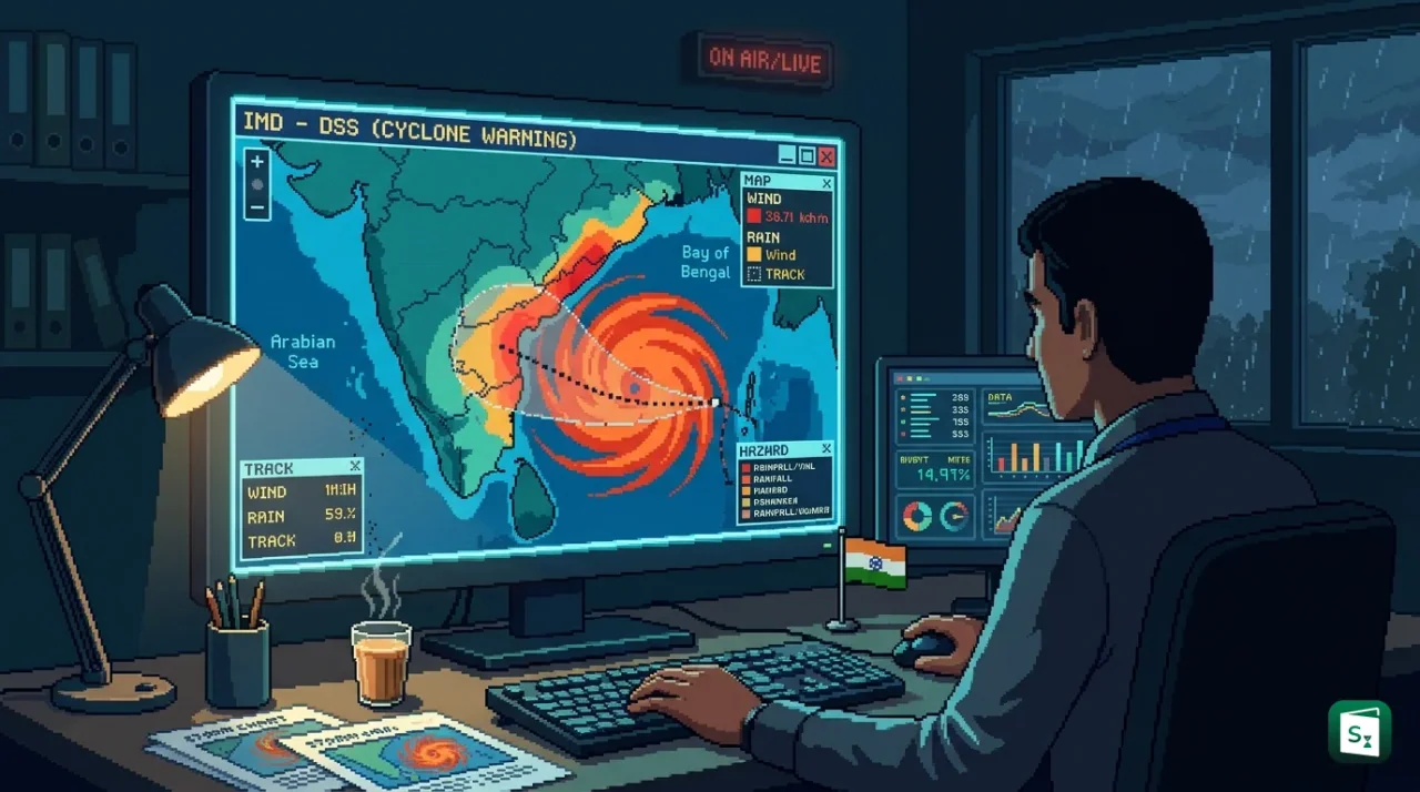
The India Meteorological Department dedicated its Cyclone Warning and Marine Weather Services Decision Support System to the nation on 12 October 2026 in New Delhi. The interactive WebGIS platform brings live cyclone track, intensity, wind, rainfall and storm surge guidance together on a single public map during the active October to December cyclone season. It is available through the Mausam portal and the Regional Specialised Meteorological Centre website to help authorities and coastal residents act faster.
What Is the Cyclone Warning Decision Support System?
The Cyclone Warning and Marine Weather Services Decision Support System (DSS) is an interactive WebGIS platform developed by the India Meteorological Department (IMD). WebGIS means maps that run in a web browser and combine location data with live weather layers. The IMD dedicated the system to the nation on 12 October 2026 during its biannual Pre-Cyclone Exercise Meeting for the post-monsoon season of October to December 2026.
The meeting was chaired by Dr. Mrutyunjay Mohapatra, Director General of Meteorology, IMD. The platform is open to the public on the IMD website at mausam.imd.gov.in and the Regional Specialised Meteorological Centre (RSMC) New Delhi website at rsmcnewdelhi.imd.gov.in, and directly at dss.imd.gov.in/dwr_img/GIS/marine.php.
The IMD presents the DSS as a bridge between forecasts and action. Instead of separate text bulletins for track, wind and rain, users see the observed and forecast track with a cone of uncertainty, district wise rainfall warnings and impact layers in one view. Disaster management authorities, state governments, port officials, fishermen and the general public can check location specific risks and decide on evacuation, port operations or fishing plans.
What the WebGIS Platform Shows: Track, Wind, Storm Surge and Rainfall
The DSS pulls together cyclone and marine weather information that was earlier spread across different bulletins and graphics. Users can view interactive maps and visualisations and zoom to their district or coastal stretch. The layers cover the full chain of cyclone hazards beyond the position of the storm centre.
The platform displays observed and forecast track with intensity and the cone of uncertainty. The cone shows the probable path area around the forecast line, which widens with lead time because small errors grow in longer forecasts. It also shows the distribution of strong winds around the centre, district wise heavy rainfall warnings, storm surge guidance and rainfall forecasts for river catchments. Storm surge is the abnormal rise of sea water pushed toward the coast by strong cyclone winds and low pressure.
For marine users, the DSS includes sea area bulletins, coastal bulletins for the zone up to 75 km from the coastline, fisherman warnings, probability of winds crossing 45 kmph and 65 kmph, and graphics for the Tropical Cyclone Advisory Centre (TCAC). River catchment rainfall forecasts help the Central Water Commission and state agencies link cyclone rain with flood risk in interior districts after landfall. This joined up view supports impact based forecasting, which explains what the weather will do rather than only describing wind speed or rainfall amount.
IMD Mausam Portal, App and Live Cyclone Tracker
The IMD provides cyclone warning today live updates through its Mausam portal, Mausam mobile app, RSMC New Delhi website and the new DSS map page. Mausam is the public weather portal of the IMD at mausam.imd.gov.in. It carries current weather, city forecasts, nowcasts, radar and satellite images, district wise warnings and specialised pages for cyclones and marine forecasts.
The Mausam app offers current weather for about 200 cities, three hourly nowcasts for about 800 stations, seven day city forecasts and colour coded district alerts for five days. Radar products are updated about every 10 minutes. The app is available on both the Play Store and the App Store and presents information without heavy technical terms.
Live tracking pages show the present position, movement and forecast path of active systems over the Bay of Bengal and the Arabian Sea. In late October 2026, for example, the IMD tracked Cyclonic Storm Arnab over the eastcentral and adjoining westcentral Bay of Bengal on these pages. City and coastal searches such as cyclone warning Chennai, cyclone warning Mumbai, cyclone warning Visakhapatnam or cyclone warning Odisha lead to the same central system. Users see district warnings, wind and rainfall layers and official bulletins rather than relying on unofficial trackers.
How Are Cyclones Predicted in India?
The India Meteorological Department predicts cyclones by combining satellite images, Doppler weather radars, ocean buoys, automatic weather stations and numerical weather prediction models. Forecasters track the low pressure system, estimate intensity with the Dvorak technique and run track and intensity models for guidance up to five days ahead.
A tropical cyclone is a rotating low pressure system over tropical seas where maximum sustained surface winds reach at least 34 knots (about 62 kmph). The word cyclone comes from the Greek word cyclos, meaning coil of a snake. The term was coined by Henry Piddington for storms in the Bay of Bengal and Arabian Sea. The same phenomenon is called a hurricane over the Atlantic Ocean and a typhoon over the Pacific Ocean. A cyclone shelter is a raised concrete building where coastal residents stay during evacuation.
Cyclones can be predicted in advance, but with limits that change with lead time. Genesis and track forecasts are now issued up to five days ahead, with higher confidence in the first three days. Intensity change, rapid intensification near the coast and exact landfall point and time remain harder to pin down. The cone of uncertainty on the DSS map communicates this growing range directly.
The IMD observation network includes surface observatories, upper air stations, satellites such as INSAT-3D and INSAT-3DR, Doppler Weather Radars along both coasts, automatic weather stations and rain gauges, buoys and ships. Inside 500 km of a coastal radar, forecasters monitor inner core winds and heavy rain bands continuously. Models used for guidance include global and regional numerical models, ensemble systems, the HWRF ocean coupled model for cyclones, and statistical tools for genesis potential and intensity.
What Is a Cyclone Warning?
A cyclone warning in India is an official alert from the India Meteorological Department about an approaching tropical cyclone. It gives the storm position, intensity, movement, landfall point, heavy rain, strong wind and storm surge risks, plus action advice for the public, fishermen, ports and disaster managers.
Four Stages of Cyclone Alerts in India
The IMD issues cyclone warnings to state officials in four stages with increasing detail as landfall nears. Bulletins start from the depression stage and are issued every three hours once the system becomes a cyclonic storm. The stages also link to yellow, orange and red colour codes used since the post monsoon season of 2006.
| Warning Stage | Lead Time | What It Contains |
|---|---|---|
| Pre Cyclone Watch | About 72 hours in advance | Early notice of a developing disturbance in the North Indian Ocean, possible intensification and coastal belt likely to face bad weather. Issued by the Director General of Meteorology to top central and state officials. |
| Cyclone Alert (Yellow) | At least 48 hours in advance | Position and intensity, likely movement, coastal districts at risk and advice for fishermen, public, media and disaster managers. |
| Cyclone Warning (Orange) | At least 24 hours in advance | Forecast landfall point and time, heavy rainfall, gale winds, storm surge, expected damage and action advice. Issued every three hours. |
| Post Landfall Outlook (Red) | At least 12 hours before landfall | Likely path after landfall and bad weather expected in interior areas. |
A watch means conditions are becoming favourable and people should stay updated. A warning means severe weather is expected and people should act on official advice. Fishermen get special warnings four times a day in normal weather and every three hours during disturbed weather.
Colour Codes and Port Warning Signals
District warnings on Mausam and the DSS use green, yellow, orange and red to show rising risk. Yellow calls for watchfulness, orange calls for readiness to act, and red calls for action and response measures. The port system is older and more detailed.
India introduced a uniform system of storm warning signals at ports on 1 April 1898. Port officers hoist visual day and night signals so mariners and fishermen can judge risk from a distance. The IMD sends the warning by high priority message and the port displays the signal.
| Signal Group | Signal Numbers | Meaning for Ports and Ships |
|---|---|---|
| Distant signals | DC-I, DW-II | Depression or cyclone far at sea. Port not yet affected, but ships leaving port may face danger. |
| Local signals | LC-III, LW-IV | Port threatened by squally weather or cyclone at sea likely to affect the port later. |
| Danger signals | D-V, D-VI, D-VII | Cyclone likely to cross the coast keeping the port to its left, right or over or near the port. |
| Great Danger and breakdown | GD-VIII, GD-IX, GD-X, XI | Severe cyclone likely to cross keeping the port to its left, right or over the port. Signal XI means communication with the warning office has failed and the port officer judges danger. |
Who Issues Warnings: IMD Institutional Framework and Coastal Coverage
The India Meteorological Department, established in 1875, is the national agency for weather observation and forecasting. It works under the Ministry of Earth Sciences and is headquartered at Mausam Bhawan on Lodhi Road in New Delhi. The IMD also serves as the Regional Specialised Meteorological Centre for tropical cyclones over the Bay of Bengal and Arabian Sea. In this role, the IMD names North Indian Ocean cyclones and issues advisories to member countries under the World Meteorological Organization framework.
Cyclone warning work is organised in three tiers. The Cyclone Warning Division in New Delhi provides national coordination, bulletins for the Indian coast, and round the clock feeds to the Ministry of Home Affairs control room, Doordarshan, All India Radio and state governments. Three Area Cyclone Warning Centres (ACWCs) at Chennai, Mumbai and Kolkata and four Cyclone Warning Centres (CWCs) at Thiruvananthapuram, Visakhapatnam, Ahmedabad and Bhubaneswar cover defined coastal strips up to 75 km inland and adjoining sea areas.
| Centre | Sea Basin | Coastal Area Covered |
|---|---|---|
| ACWC Kolkata | Bay of Bengal | West Bengal and Andaman and Nicobar Islands |
| ACWC Chennai | Bay of Bengal | Tamil Nadu, Puducherry, Karaikal and parts of the southwest coast in the operational scheme |
| ACWC Mumbai | Arabian Sea | Maharashtra and Goa |
| CWC Thiruvananthapuram | Arabian Sea | Kerala, Karnataka, Lakshadweep and Mahe |
| CWC Ahmedabad | Arabian Sea | Gujarat, Daman and Diu, Dadra and Nagar Haveli |
| CWC Visakhapatnam | Bay of Bengal | Andhra Pradesh including Yanam |
| CWC Bhubaneswar | Bay of Bengal | Odisha |
The October 2026 Pre-Cyclone Exercise Meeting shows how the network works in practice. The IMD has held this coordination meeting twice a year since 2008 to review readiness for the coming season, check action taken on earlier decisions and share new tools. The October 2026 meeting brought together about 230 participants from more than 30 organisations, with 180 joining online and 50 in person. Participants included the National Disaster Management Authority (NDMA), National Disaster Response Force (NDRF), Ministry of Home Affairs, Indian Navy, Indian Air Force, Indian Coast Guard, Central Water Commission, fisheries departments, coastal states and Union Territories, ports and scientific bodies such as the National Centre for Medium Range Weather Forecasting.
Why the New System Matters for Disaster Preparedness and Public Safety
India faces two cyclone seasons each year, with the sharpest activity in October to November over the Bay of Bengal and a secondary peak in May. Nine coastal states and island territories, from Gujarat and Maharashtra on the west to Tamil Nadu, Andhra Pradesh, Odisha and West Bengal on the east, depend on early warnings. The date of the DSS launch carries its own reminder. The IMD had accurately forecast Very Severe Cyclonic Storm Phailin (2013) and Very Severe Cyclonic Storm Hudhud (2014), both of which crossed the coast on 12 October. Those forecasts earned global recognition and cut loss of life sharply in later events.
The DSS builds on that progress by turning complex data into clear local guidance. A district collector can check which blocks face red level rain, a port officer can match surge and wind layers with signal rules, and a fishing community can see when seas become unsafe. The platform also feeds the wider multi hazard system built under Mission Mausam, which links cyclone, heavy rain, heatwave, thunderstorm and marine alerts on a GIS base and shares them through SMS, email, apps, the Common Alerting Protocol (CAP) and the Mausamgram service for village level forecasts.
The long term test will be regular use. If state control rooms, municipal bodies and coastal residents check the same interactive map during every depression and cyclone alert, evacuation planning, shelter management and relief positioning can start earlier. The IMD has said the live demonstration at the October meeting drew suggestions from users and that feedback will be used to improve the platform and its operational value.
Key Takeaways
- The Cyclone Warning and Marine Weather Services DSS was dedicated to the nation on 12 October 2026 during the Pre-Cyclone Exercise Meeting for October to December 2026.
- The WebGIS platform shows observed and forecast track with cone of uncertainty, wind distribution, district rainfall warnings, storm surge and river catchment rainfall on interactive maps.
- The system is publicly accessible through mausam.imd.gov.in, rsmcnewdelhi.imd.gov.in and directly at dss.imd.gov.in/dwr_img/GIS/marine.php.
- India issues cyclone alerts in four stages: Pre Cyclone Watch at 72 hours, Cyclone Alert at 48 hours, Cyclone Warning at 24 hours and Post Landfall Outlook at 12 hours.
- The IMD, established in 1875 under the Ministry of Earth Sciences, works with 3 ACWCs and 4 CWCs and serves as the RSMC for the Bay of Bengal and Arabian Sea. |