

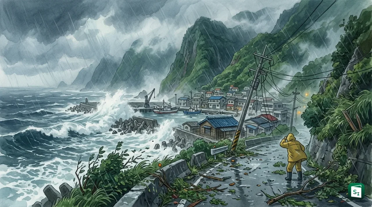
Typhoon Champi brushed past the northeastern coast of Taiwan on 24 October 2026, staying just offshore near Yilan County after a rare midnight loop. The storm killed one person, injured 527 people and knocked out power lines across the island with gusts touching 227 kmph in coastal areas. Taiwan ended its land warning on the afternoon of 24 October as Champi weakened to a tropical storm and turned north toward Japan.
What Is Typhoon Champi?
Typhoon Champi is the 30th numbered typhoon of the 2026 Pacific typhoon season, named by Laos after the red jasmine flower. The Japan Meteorological Agency (JMA), which is the official warning centre for the western North Pacific, tracked it as Typhoon No. 30, while the United States Joint Typhoon Warning Center (JTWC) listed it as Tropical Storm 29W. At its peak on 20 to 21 October, Champi became a super typhoon and one of the strongest storms in the Pacific in 2026.
Champi first developed as a tropical depression east of the Philippines around 14 October and moved slowly west and northwest. It intensified rapidly over very warm ocean water. Central pressure fell to 900 hectopascals (hPa) on 21 October, with maximum sustained winds of more than 200 kmph near the centre and gusts above 300 kmph, according to the JMA. For comparison, standard air pressure at sea level is about 1013 hPa, so a lower number means a more powerful storm.
By 23 October, Champi had weakened but was still classified as a large and strong typhoon. It carried sustained winds of 155 kmph with gusts up to 191 kmph and a storm radius of 320 kilometres, wide enough to cover most of Taiwan even without direct landfall. Taiwan downgraded Champi to a tropical storm on the afternoon of 24 October when sustained winds fell to around 108 kmph.
What Is a Typhoon and How Does It Form?
A typhoon is a rapidly rotating storm system with a low pressure centre, strong winds and heavy rain that forms over the northwestern Pacific Ocean. The same type of system is called a hurricane over the North Atlantic and northeastern Pacific, and a cyclone over the Indian Ocean and South Pacific. Scientists use tropical cyclone as the common name for all three.
Typhoons form only when several conditions come together. The sea surface must be warmer than 27 degrees Celsius through a depth of about 46 metres, because warm water vapour is the fuel of the storm. The air above must be moist and cool quickly with height, which helps clouds rise and release heat. The system must also be at least 480 kilometres away from the equator so that the Coriolis force, the turning effect caused by the rotation of the Earth, can start the spin. Finally, vertical wind shear, the change in wind speed with height, must be low, or it will tear the rising clouds apart.
The process starts as a cluster of thunderstorms linked to a weather disturbance such as an easterly wave, which is a bend of low pressure moving west in tropical winds. Warm moist air rises, cools and condenses into clouds, and the released heat makes the air lighter so more air flows in at the surface. This inflow creates strong winds that rotate counter clockwise in the Northern Hemisphere. When sustained winds reach 39 miles per hour (63 kmph), the system becomes a tropical storm and gets a name. When winds cross 74 miles per hour (119 kmph), it becomes a typhoon.
Typhoon Champi shows why typhoons weaken over land and over cooler water. A typhoon loses its main energy source once the centre moves over land, because land does not supply heat and moisture like the ocean. Friction with hills and buildings also breaks the circulation. Champi weakened quickly on 24 to 25 October as it met strong wind shear of 30 to 35 knots, dry air and sea temperatures of only 25 to 26 degrees Celsius north of Taiwan, and the JTWC later described it as an elongated trough without deep convection.
Typhoon Champi Path and Intensity Timeline
Typhoon Champi travelled more than 3,000 kilometres in about 11 days. The storm began far east of the Philippines, moved west northwest, then turned sharply north along the east coast of Taiwan before heading toward southern Japan and the East China Sea. This looping northward turn is typical when a typhoon reaches the edge of the Pacific high pressure system and gets caught by westerly winds from the mid latitudes.
Taiwan weather officials closely watched Champi on the night of 23 to 24 October because the eye behaved in an unusual way. At about 1.27 am on 24 October, the centre reached a point over the sea just outside Suao township in Yilan County and stopped only 1 kilometre short of making landfall. It then hugged the Yilan coast, turned south briefly around midnight and made a rare loop offshore before moving north again. Forecasters said such stalling, looping or wobbling can change landfall forecasts at the last moment.
| Date in October 2026 | Location and Movement | Intensity and Wind Speed |
|---|---|---|
| 14 to 16 October | Forms east of Philippines, moves west northwest | Tropical depression to tropical storm, winds 50 to 110 kmph |
| 17 to 19 October | Moves over open Pacific east of Philippines | Rapid intensification to violent typhoon, pressure falling to 935 hPa |
| 20 to 21 October | Peak phase east of Taiwan, slows to 15 to 25 kmph | Super typhoon, 900 hPa, sustained winds over 200 kmph, gusts over 300 kmph |
| 22 October | About 250 km southeast of Yilan, radius expands to 320 km | Strong typhoon, gusts up to 227 kmph near centre |
| 23 October | Southeast of Yilan, moving north northwest at 11 to 15 kmph, passes 150 km east of Taiwan | Typhoon with 155 kmph sustained winds and 191 kmph gusts |
| 24 October | Loops off Suao in Yilan, then moves north northeast at 18 to 21 kmph | Downgraded to tropical storm, sustained winds about 108 kmph, gusts 144 kmph |
| 25 to 26 October | Moves over East China Sea southwest of Sasebo in Japan at 20 kmph | Tropical storm with 65 kmph winds and 1002 hPa pressure, turning extratropical |
Impact on Taiwan Northeast Coast
Taiwan recorded one death and 527 injuries by the end of 24 October after Champi grazed its northeastern coast. The death occurred on 22 October when a man was swept away by large waves off Liuqiu Island near Pingtung in the southwest. Most injuries came from traffic accidents, falls and flying objects in strong gusts. The Central Weather Administration (CWA), which is Taiwan official weather agency responsible for typhoon warnings, reported gusts of about 227 kmph in some coastal parts of Yilan and New Taipei even though the centre stayed at sea.
Rainfall was the other major hazard. The CWA forecast total rainfall of 90 centimetres in northern mountains between 22 and 24 October, with peak rain on the morning of 24 October. Mountain areas around Taipei and the Wanli River barrier lake in Hualien County were placed under watch for flash floods, landslides and overflow. Long waves higher than 6 metres hit eastern, northeastern and northern coasts, so authorities warned people to stay away from beaches and mountains.
Daily life came to a halt. Taiwan shut schools and offices in nearly all 22 counties and cities on 23 October, a practice locally called a typhoon holiday. All 262 domestic flights were cancelled along with 669 international flights, and the Danjiang Bridge between Tamsui and Bali in New Taipei was closed from the afternoon of 23 October. More than 1,000 residents were evacuated from landslide prone villages, while high speed rail on the western coast ran normally and Taipei metro stayed open.
Power and property damage was widespread but localised. Strong winds downed trees and power lines in Yilan, Keelung, Taipei and New Taipei, and sent roof sheets flying. Residents in Yilan described the night of 23 October as sleepless, with banana trees uprooted and the strongest winds in many years. The Central Emergency Operation Center, which President Lai Ching-te visited in New Taipei City, coordinated rescue, power restoration and road clearance. Sea and land typhoon warnings were lifted in stages on 24 October, starting with the land warning at 2.30 pm when the storm was 260 kilometres northeast of Taipei.
Japan Track and Regional Extension
Typhoon Champi did not stop at Taiwan. The JMA forecast shows Champi tracking north through the East China Sea, passing close to the Sakishima Islands in Okinawa Prefecture and then curving northeast toward Kyushu around 26 October before becoming an extratropical low south of Honshu by 27 October. An extratropical low is a former tropical storm that has lost its warm core and now gets energy from contrasting air masses, but it can still bring strong winds and heavy rain.
Japan felt the first effects on 23 and 24 October. Champi came within 160 kilometres south southwest of Ishigaki Island on 23 October, moving north northwest at 15 kmph with central pressure of 955 hPa and sustained winds of 144 kmph with gusts up to 216 kmph. Yonaguni Airport recorded gusts of about 150 kmph and Ishigaki City recorded 148 kmph. Waves around the Sakishima Islands were forecast to reach 12 metres, with 8 metres around Okinawa Island. Some households in Okinawa suffered power outages, and up to 250 millimetres of rain in 24 hours was forecast for parts of Okinawa Prefecture.
The JMA warned of violent winds that could damage houses, high waves with storm surge and a band of heavy rain clouds that sharply raises landslide risk. Forecast sustained winds were 144 kmph on 23 October and 126 kmph on 24 October for the Sakishima Islands, with peak gusts of 180 to 198 kmph. The storm was expected to activate the seasonal rain front over western and eastern Japan, increasing rain even before the centre arrived. Travellers were advised to track live satellite maps and official JMA and CWA updates, since typhoon trackers show the forecast cone shifting as wind shear and dry air change the storm shape.
Typhoon Season in Taiwan and Japan
The typhoon season in Taiwan normally runs from June to October, with most storms arriving in July and August. Champi arrived late in the season, and if its eye had made landfall it would have been the first such late October landfall in northern Taiwan in 57 years. Late season storms are still dangerous because they can combine with the northeast monsoon to dump extreme rain on northern and eastern Taiwan. Taiwan weather data shows that a typhoon is declared to have made landfall only when its centre or eye moves from sea onto land, but damage from rain and wind can be severe even without landfall.
Japan typhoon season follows a similar calendar, with peak activity in August and September. The Japan Meteorological Association had forecast in May 2026 that 2026 would see average or above average approaches in August, and that autumn storms could be strong and well developed because of a possible shift toward El Nino conditions. El Nino is a warming of the central and eastern Pacific that can shift typhoon formation further southeast, giving storms a longer run over warm water to strengthen. Champi fits that pattern, since it formed far to the southeast and travelled a long distance before peaking as a super typhoon.
The 2026 Pacific typhoon season has been active overall. Early storms included Nokaen in January, Sinlaku in April, Bavi in early July and Dolphin in late July, which struck Okinawa and Zhejiang in China. Champi, as the 30th numbered storm, shows how the season can stretch into late October. Taiwan today receives regular typhoon updates through CWA land and sea warnings, mobile alerts for waves and destructive winds, and holiday announcements from local governments.
Typhoon vs Hurricane vs Cyclone
Typhoon, hurricane and cyclone are different names for the same weather system. The name changes only with location. Storms over the northwestern Pacific, which includes Taiwan, Japan, the Philippines and the east coast of China, are called typhoons. Storms over the North Atlantic and northeastern Pacific are called hurricanes. Storms over the South Pacific and Indian Ocean are called cyclones or severe tropical cyclones. All three draw energy from warm ocean water and have organised rotation around low pressure.
The difference in terminology matters for tracking agencies. The JMA names and numbers typhoons in the western North Pacific, while the United States National Hurricane Center names hurricanes in the Atlantic and eastern Pacific. The World Meteorological Organization (WMO), the United Nations agency for weather based in Geneva, coordinates the naming lists through its regional bodies. Wind speed thresholds are the same everywhere.
| System Stage | Maximum Sustained Wind Speed | What It Means |
|---|---|---|
| Tropical depression | Below 63 kmph (below 34 knots) | Closed circulation but weak winds, heavy rain possible |
| Tropical storm | 63 to 118 kmph (34 to 63 knots) | Gets a name such as Champi, gale force winds extend outward |
| Typhoon, hurricane or cyclone | Above 119 kmph (above 64 knots) | Full tropical cyclone with eye, destructive winds and storm surge |
| Severe typhoon or super typhoon | Above 185 kmph in JMA practice, above 241 kmph for super typhoon in JTWC practice | Most intense class, like Champi at its peak with gusts over 300 kmph |
Champi moved through all these stages. It rose from a depression to a super typhoon and then fell back to a tropical storm and an extratropical low. This is why Taiwan and Japan report both sustained winds, which are averaged over 10 minutes by JMA, and gusts, which are short bursts that cause most roof and power line damage.
How Are Typhoons Named?
Typhoons in the western North Pacific are named from a shared list of 140 names contributed by 14 members of the ESCAP/WMO Typhoon Committee. ESCAP stands for the Economic and Social Commission for Asia and the Pacific. Each member, which includes countries such as China, Japan, the Philippines, Vietnam and Laos, contributes 10 names that reflect local culture, nature or history. The names are used in order, one after another, without regard to year. Once the list ends, it starts again from the beginning.
The name Champi was contributed by Laos and means red jasmine flower. It sits in Column IV of the official list between Koguma from Japan and In-fa from Macao, China. The JMA assigns both the name and a four digit number, such as Typhoon No. 30 in 2026, once sustained winds reach tropical storm strength. If a typhoon causes very severe damage, its name can be retired and replaced, so particularly destructive names are not reused.
The Philippines also gives its own local name to storms that enter its area of responsibility. Japan numbers typhoons separately as Reiwa 8 Typhoon No. 30, since 2026 is the eighth year of the Reiwa era. The dual system explains why Champi appears in different trackers as Typhoon 202630, Typhoon No. 30 and Tropical Storm 29W. All three labels refer to the same storm.
Recovery and Next Forecast for Japan and Taiwan
Taiwan moved quickly into recovery on 24 October. Train services resumed, road traffic increased ahead of a three day holiday and the Danjiang Bridge was scheduled to reopen at 5 pm. Power crews worked to restore lines in Yilan and northern districts, while disaster teams continued to watch river levels and the barrier lake in Hualien for delayed flooding. The CWA said rain and wind would continue through the evening of 24 October but the worst had passed.
Japan remains the focus. The JMA expects Champi, now a weakening tropical storm, to veer east and approach western Japan before turning into a low pressure system south of Honshu. Even as a low, it can strengthen the nearby rain front and bring heavy rain to Kyushu, Shikoku and parts of Honshu. The JTWC issued its final warning on 25 October, noting that Champi had opened into a trough and would continue northeast while degrading further. Residents in Okinawa, Amami and Kyushu were asked to stay alert for high waves, gusts that can break windows and flood low lying coastal roads.
Key Takeaways
- Typhoon Champi grazed Taiwan northeast coast near Yilan County on 24 October 2026 without full landfall, stopping 1 km off Suao.
- The storm caused 1 death off Liuqiu Island and 527 injuries, with gusts up to 227 kmph and a storm radius of 320 km.
- At its peak on 20 to 21 October, Champi was a super typhoon with central pressure of 900 hPa and gusts above 300 kmph.
- The name Champi, meaning red jasmine flower, was contributed by Laos under the ESCAP/WMO Typhoon Committee naming system.
- A typhoon becomes a tropical storm at 63 kmph and a typhoon at 119 kmph, and the same system is called a hurricane in the Atlantic and a cyclone in the Indian Ocean.